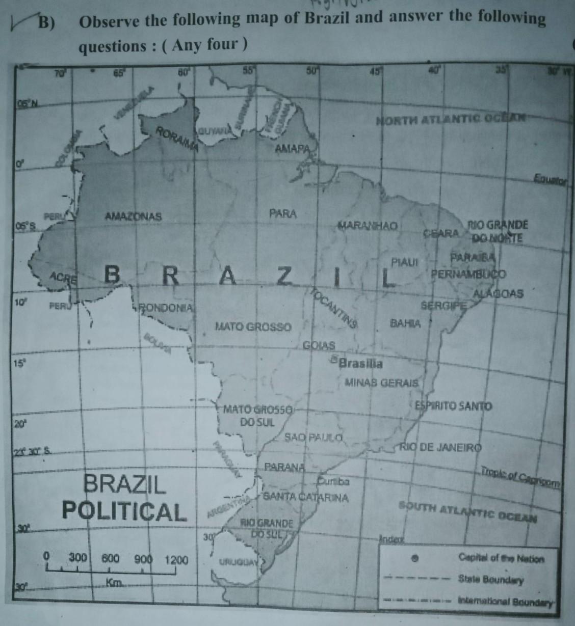
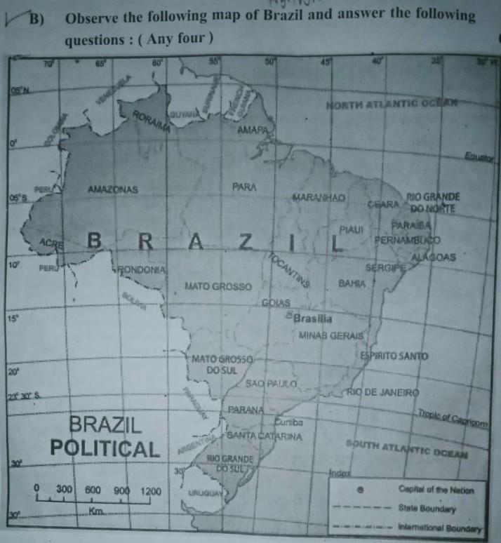
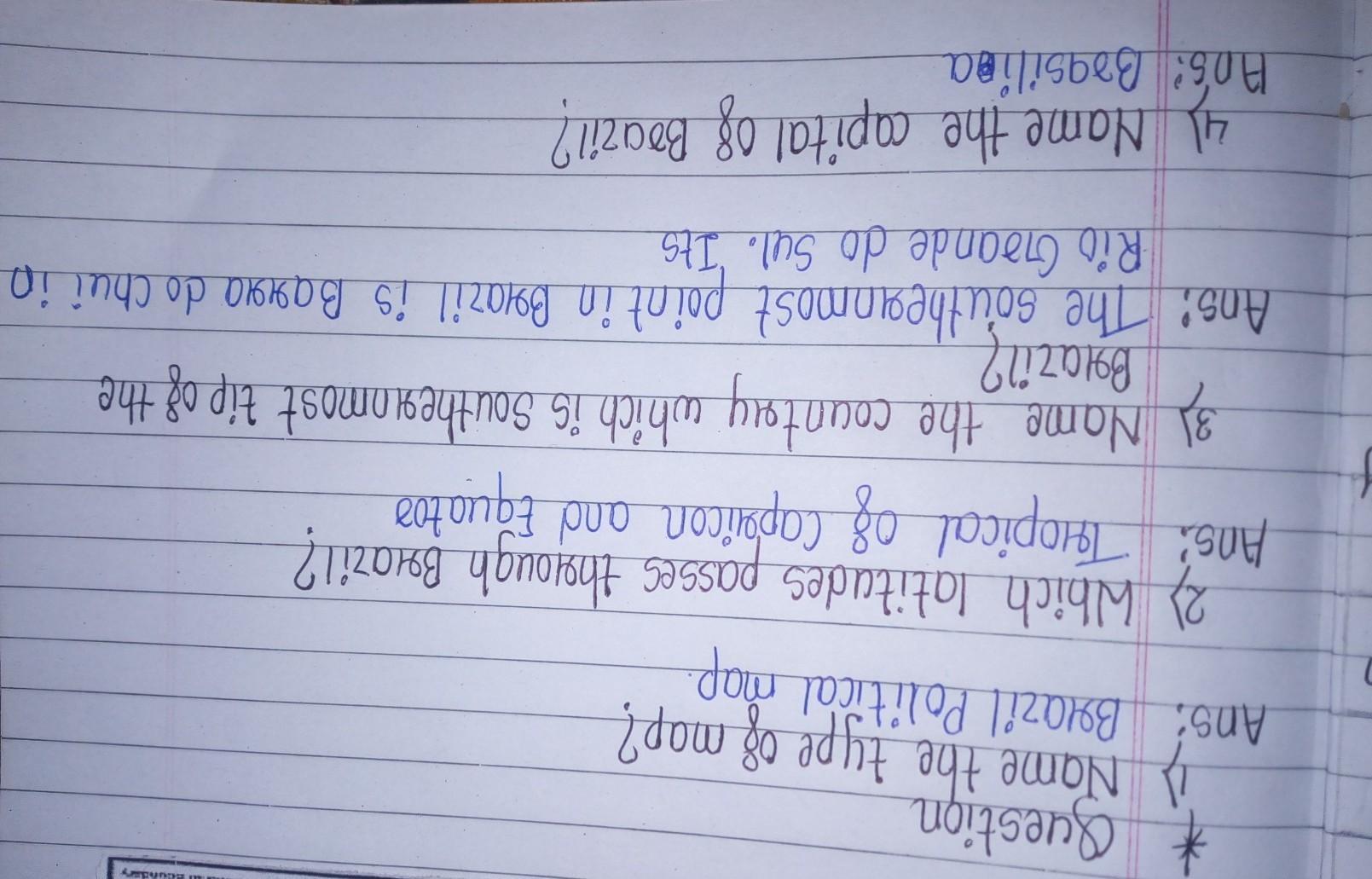
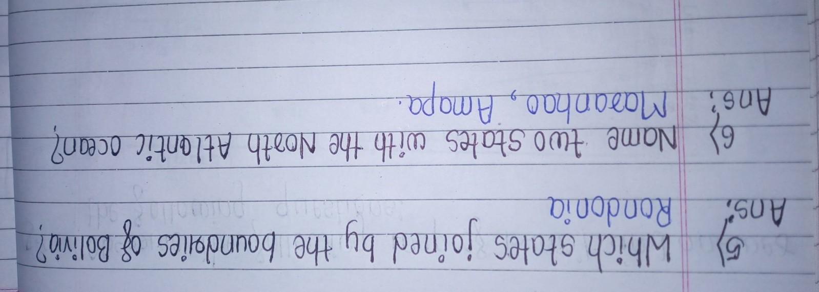
Q.1) Answer the following questions. 1) Name the type of map? 2) Which latitudes passes through Brazil? 3) Name the country which is Southernmost tip of the Brazil? 4) Name the capital of Brazil? 5) Which states joined by the boundries of Bolivia? 6) Name two states with the North Atlantic ocean?(Answer should be correct please..)
Answers 2
Answer:
1) Political Map
2) The Tropic of Capricorn (23 1/2° S) and Equator passes through Brazil.
3) The southernmost point in Brazil is Barra do Chui in Rio Grande do Sul. Its coordinates are 33.75250°S and 53.36861°N.
4) Brasília
5) Bolivia is border with :
north and east by Brazil, to the southeast by Paraguay, to the south by Argentina, to the southwest and west by Chile, and to the northwest by Peru.
6) Virginia and North Carolina
-
Author:
daniak2dv
-
Rate an answer:
7
Explanation:
Please like and share this ans
-
Author:
belch8li6
-
Rate an answer:
4
If you know the answer add it here!
Choose a language and a region
How much to ban the user?
1 hour
1 day
100 years

